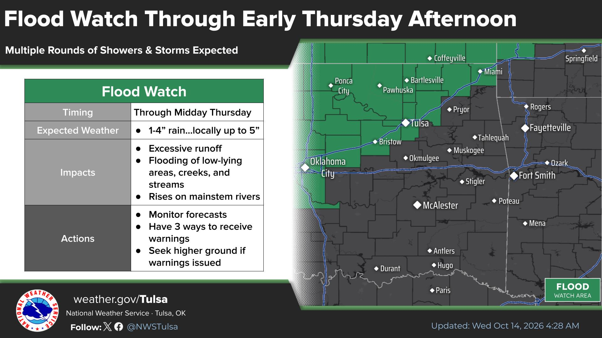
A Flood Watch covers the Tulsa area through Thursday, Oct. 15, with up to 5 inches of rain possible. The National Weather Service Tulsa office issued the watch as multiple rounds of storms target northeast Oklahoma.
The watch applies to counties along and north of Interstate 44. Rainfall totals of 1 to 3 inches are expected across the watch area, with isolated spots receiving 4 to 5 inches.
Some thunderstorms could produce rainfall rates exceeding 2 inches per hour, KJRH meteorologist Anne Brown reported. Flash flooding is possible where repeated storm rounds move over the same locations.
NWS Tulsa flagged the threat on X on Tuesday, Oct. 13:
@nwstulsa: "Several rounds of showers and storms with torrential downpours will impact the area through Thursday morning. Localized amounts up to 5" possible across portions of NE #OKwx."
Beyond flooding, a few strong to severe thunderstorms are possible Wednesday, Oct. 14, along and north of I-40, Brown reported. Wind gusts exceeding 65 mph are the primary severe concern. Large hail is also possible, and a brief tornado cannot be ruled out near a surface boundary.
Storm activity may continue into Wednesday night and Thursday morning. Additional thunderstorms could develop along a cold front Thursday afternoon, though the severe threat is expected to be lower.
Temperatures will stay in the 70s and lower 80s Wednesday and Thursday. That warmth follows a record-tying day in Tulsa: the city hit 92 degrees on Tuesday, Oct. 13, matching its Oct. 13 record set in 1963, according to The Watchers. That reading was 17 degrees above normal.
Conditions change sharply by Friday, Oct. 16. A strong cold front will push through Green Country late Thursday, bringing gusty north winds and much cooler air. Highs Friday will drop into the 60s with mostly clear skies. Overnight lows Friday and Saturday nights could dip into the upper 30s and 40s.
Comfortable conditions are expected through the weekend, Brown reported. Temperatures will begin to rebound early the following week, with highs returning to the 70s.
Residents in the watch area should avoid driving through flooded roadways and monitor alerts from the NWS Tulsa office for updates.